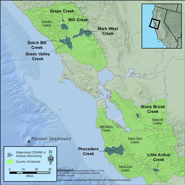
Streamflow Data Center
CEMAR's Conservation Hydrology program currently maintains stream gauges in eight different watersheds scattered over five counties. Click on a watershed name on the map or the hyperlinks below the map to see a close up of the watershed and gauge location/information.
Please note the following disclaimer:
The data reported here are preliminary, have not been verified, and may be unreliable for reasons including, but not limited to, instrument malfunction, undetected disruptions or interference occurring at the measurement site, or errors in interpretation. Please note that data are currently available only for water depth (not flow), temperature data has not been reviewed or calibrated, instruments may be located above the water levels in pools, and some instruments measure stage up to a certain height and will display a flat line at zero or the maximum height once that maximum measurable stage is reached.
|

